Guide to Navigating Public Transportation on Marathon Monday in Boston
The MBTA has tons of options along the T's Green Line and the Commuter Rail's Worcester Line to get you close to the race course.

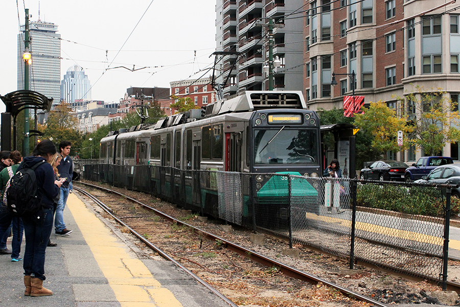
Photo by Olga Khvan
Yes, your car is comfortable, clean, and all your own. Yes, driving is smoother, faster, and devoid of strangers playing music on their phones without wearing their headphones. But no, you should not plan to drive to Boston on Marathon Monday.
First of all, roads along the route will be closed from Hopkinton to Boston in intervals throughout the day, and parking near the finish line will be restricted to a few garages near Boylston St. If you insist on driving, be sure to check out the detailed road closure information on the City of Boston and Boston Athletic Association websites so you don’t end up missing all the action because you were stuck in gridlock.
Luckily, the MBTA will be out in full force to shuttle race revelers from mile one to the finish line. But before you grab your clear bag full of granola bars, water bottles, and an emergency poncho, peruse our public transit guide to make your Patriots Day as hassle-free as possible.
Station Closures and Bus Changes
A handful of T stops will be closed for the majority of Marathon Monday. Copley Station, which is the closest stop to the finish line, will be out of commission all day, and the following will be closed from 10 a.m. to 6 p.m.:
- Saint Mary’s Street (C Branch, Green Line)
- Kent Street (C Branch, Green Line)
- South Street (B Branch, Green Line)
Several MBTA bus routes will be rerouted for portions of Patriots Day, and specific, up-to-date service information can be found on the T’s website. Routes 55 from Fenway to the Back Bay; 502 from Watertown to the Back Bay; and 503 from Newton to the Back Bay will not run at all on race day. Additionally, the following routes will be on abnormal schedules on Monday: 8, 9, 10, 19, 47, 52, 57, 59, 60, 62, 65, 66, 76, 86, 94, 95, 96, 101, 134, and 504.
Parking
Again, avoid driving if you can. But if you’re itching to watch the athletes cross the starting line, parking spots are available in the Hopkinton State Park lot off Route 85 and South Street lot on Route 495. A limited number of shuttles will be on-hand in Hopkinton to transport spectators to the beginning of the course until 1 p.m.
As for parking in Boston, make sure to double check the city’s website before you leave your vehicle. Parking restrictions are in place throughout the Back Bay, and the BAA is encouraging spectators to take advantage of the Garage @ 100 Clarendon, which is just a block from the finish line.
Where to Watch: Miles 1-16
The first 22 miles of the marathon stretch from Hopkinton to Newton, and though the starting line itself isn’t particularly accessible via public transportation, there are 10 commuter rail stations along the Worcester Line within a mile of the course. If you’re looking to catch the earliest moments of the race, hop off the commuter rail at the Ashland station, which lies between miles 3 and 4.
Later along the course, disembark at West Natick or Natick to meet the runners at mile 9, where Lake Cochituate provides a stunning backdrop for athletes and spectators alike. Then, hop off the Commuter Rail at Wellesley Square, Wellesley Hills, or Wellesley Farms to congratulate the runners for making it half way and to experience the famed Wellesley College scream tunnel.
Where to Watch: Miles 16-26.2
The T will be your greatest ally in effectively navigating the final stretch of the Marathon, with several stops along the way adjacent to the course.
The Woodland Station on the Green Line’s D Branch is nestled between miles 16 and 17 in Newton, providing those traveling from downtown Boston with easy access to the back half of the race. The Newton Centre and Reservoir Stations on the D Branch are also just steps away from the course.
If you’re aiming to support runners when they need it most, take the B Branch of the Green Line out to Boston College and walk about a mile west to Heartbreak Hill. If you don’t feel like making the walk, stick around the BC area for a jubilant atmosphere packed with college students. Once you’ve had your fill, you can hop back on the B Line and head inbound toward the finish line.
The C Branch of the Green Line provides riders with a front-row seat to the race as runners traverse Brookline. Beginning between miles 22 and 23, the T runs parallel with the race course along Beacon St., passing every C Branch stop from Cleveland Circle to Saint Mary’s Street. This trip is one of those special journeys that makes the frequent headaches of an above-ground transit system worth it.
Reaching the finish line
Runners end their 26.2 mile journey on Boylston Street near the Boston Public Library. Since Copley will be closed, your best bets are to hop off the Green Line at Hynes Convention Center, Arlington, Prudential, or Kenmore. Those relying on the Orange Line or Commuter Rail will want to get off the train at Back Bay to reach the finish line; you can also walk over from the Yawkey commuter rail station.
Several bus routes—including the 9, 39, 170, 502, and CT1—also stop near Copley Square, but, of course, riders should expect delays and diverted routes on race day.
Anything else?
If you’re planning to use public transportation, leave your bike at home. Because of anticipated crowds on the T, the MBTA will not allow bicycles on any of its vehicles on Monday.

